Toward Freedom’s online panel discussion, “Breaking the Colonial Grip on African Journalism,” launched the Africa Reporting Fund. The fund is designed to enable Toward Freedom to publish more reports from and about Africa. The discussion took place on May 24—the day of Eritrea’s 32nd independence anniversary and one day before African Liberation Day—to hear from African journalists about how they best see to break the colonial grip on African journalism. Panelists included Washington, D.C.-based Ivorian journalist, professor and author Gnaka Lagoke and Nairobi-based Kenyan journalist Erick Gavala, the operations manager at digital Pan-African media outlet, African Stream. Toward Freedom editor Julie Varughese moderated this discussion. To support the Africa Reporting Fund, contribute here.
Related Articles
Admin
Police Reportedly Shoot and Abduct Swaziland Communist Amid Protests Against Africa’s ‘Last Absolute Monarchy’
Editor’s Note: This article originally appeared in Peoples Dispatch.
The Communist Party of Swaziland (CPS) reported on February 28 that the police force of Africa’s last absolute monarchy has shot and disappeared one of their members, Mvuselelo Mkhabela, age 21. “Comrade Mvuselelo was badly shot at and dragged to the police van helplessly and his whereabouts and condition is unknown and the armed to teeth police force continued its attacks to the protesting community,” CPS tweeted. Reportedly this abduction happened at around 13:00h (local time) on February 28.
This latest act of violence by the Swaziland police force comes amid an uptick in police repression of recent protests against the “farcical” parliamentary elections. CPS claims that the elections are a farce because the parliament itself is under the control of the monarchy, so the electoral process constitutes “a tool used by the absolute monarchy to sanctify King Mswati’s decision.” Mvuselelo himself was arrested and tortured earlier this month for protesting these elections, which are set to occur this August. Shortly after his arrest, Mvuselelo told Peoples Dispatch, “Often, when [police] invade communities, there is no one to defend the family or the individual from the wrath of the regime. This cannot go on.” Mvuselelo was abducted today in one such police invasion.
Communists in Swaziland have been involved in a struggle against the monarchy for decades. In recent months, the regime led by King Mswati III has intensified attacks against pro-democracy activists, including the assassination of human rights lawyer Thulani Maseko, threats against union leader Sticks Nkambule, torture of union leader Mbhekeni Dlamini, and more.
“Mvuselelo’s consciousness and commitment to the just course of the people of Swaziland fighting for democracy in the face of a militarized system of oppression presided by Mswati and his political elites remains unwavering,” CPS wrote in a tweet.

Admin
Activists Say Police Are Lying About Shooting a Cop City Protester in Atlanta
BREAKING: Activists in Atlanta say that police are lying about what happened when a protester was shot and killed Wednesday.
The activists say police were hit with friendly fire when raiding their encampment, and that the activist killed, Tort, did not shoot them. pic.twitter.com/7U5JrkTj8k
— BreakThrough News (@BTnewsroom) January 20, 2023
Admin
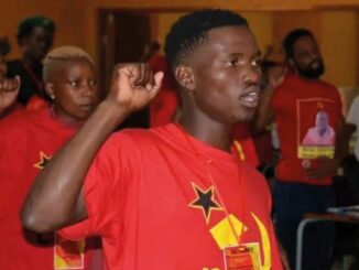
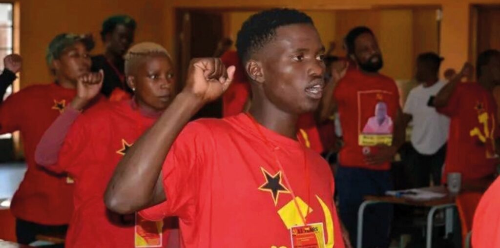
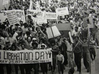
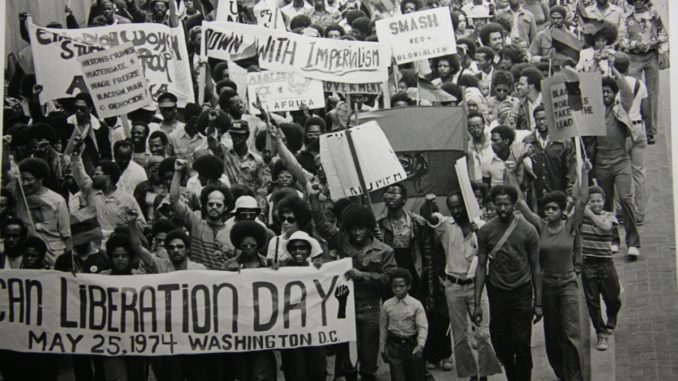
African Liberation Day & Q&A with Kwame Nkrumah’s Son, Gamal
Editor’s Note: The following is excerpted from the Black Alliance for Peace’s AFRICOM Watch Bulletin.
African Liberation Day (ALD), celebrated on May 25, has its origins in the long struggle of African people to liberate themselves from European domination and white supremacy. It is a time in which we emphasize our oneness as a people with a common past, common set of problems and a common future.
The capture of millions of African people, who were enslaved and introduced into the Western Hemisphere as property and commodities, is the backdrop upon which we commemorate ALD. The colonial-capitalist system imposes a divide between the millions of Africans kidnapped to the Americas during the Transatlantic slave trade and those left on the African continent.
ALD is a vehicle to continue to highlight the problems, challenges and the future of African people everywhere. The challenges facing Africa and African people worldwide require that we remain dedicated to the cause of Africa’s liberation. We can continue to showcase that dedication by actively participating in ALD activities held throughout the world.
U.S. Out of Africa: Voices from the Struggle
Gamal Nkrumah is a Ghanaian journalist, a Pan-Africanist and an editor of Al Ahram Weekly newspaper. He is the eldest son of the first president of Ghana, Kwame Nkrumah.
AFRICOM Watch Bulletin: Could you speak about the history of African Liberation Day?
Gamal Nkrumah: May 25th is celebrated as African Liberation Day. The day marks the foundation of the Organization of African Unity (OAU) in Addis Ababa, Ethiopia in 1963. The formation of the OAU was a key moment in a centuries-long struggle against colonialism, capitalism, and imperialism.
For more than 500 years, African people have been dehumanized and degraded, with their bodies and labor commodified to enrich a ruling elite. From slave labor on cotton and sugar plantations to the extraction of gold and diamonds from the earth, the development of Europe and the Americas happened through the rapid exploitation of African people.
Through the collective experiences of deprivation, African people in the diaspora and continent developed a resistance movement. There were many milestones in this process: the formation of independent, maroon communities by former slaves and Afro-Caribbean people, the first Pan-African congress held in 1900, the fifth Pan-African Congress in Manchester, 1945.
Over the decades, political consciousness grew around the necessity to wage a revolutionary, Pan-African struggle against colonial and imperial rule in the 20th century. The revolutionary anti-colonial movements culminated in the mid-century with the independence of several African nations from European powers and the formation of the Organization of African Unity.
AWB: How does ALD relate to the struggles of African people today?
Gamal Nkrumah: African Liberation Day, as it came to be known, was born from the fierce fight for a new society. As Kwame Nkrumah said, “The African Revolution, while still concentrating its main effort on the destruction of imperialism, colonialism and neocolonialism, aims at the same time to bring about a radical transformation of society. The choice has already been made by the workers and peasants of Africa. They have chosen liberation and unification… for the political unification of Africa and socialism are synonymous. One cannot be achieved without the other.”
Today, capitalism continues to brutally ravage and exploit Africa and its people. The West, through their militaries as well as the IMF and World Bank, have consistently imposed a neocolonial agenda on the continent, and the Organization of African Unity, now known as the African Union, is a puppet of capital and elite interests.
African people on May 25 celebrate the victories of revolutionary Pan-Africanism. African Liberation Day recalls the long history of struggles against class exploitation, colonialism and imperialism.
Revolutionary Africans know that attaining full emancipation demands a revolution from below, in the interests of people over profit. The only antidote to this colonial-capitalist system that continues to impoverish African people is an organized force in Africa ready to pursue Pan-Africanism under scientific socialism.