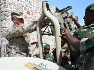
Editor’s Note: This video report was published by African Stream.
Mali bans French-supported and -funded NGOs from operating within its borders.
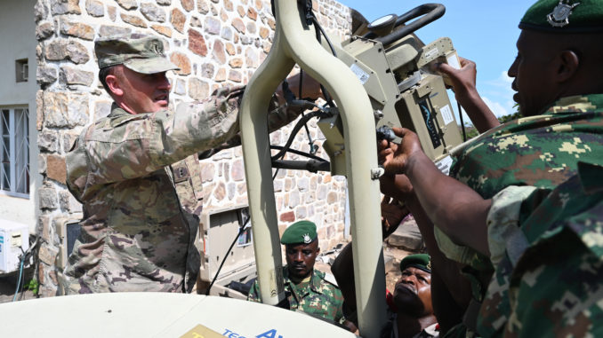
Editor’s Note: This video report was published by African Stream.
Mali bans French-supported and -funded NGOs from operating within its borders.
Editor’s Note: This was excerpted from the Black Alliance for Peace’s AFRICOM Watch Bulletin.
The imperialist powers are bent on exploiting the labor and looting the mineral wealth of as many poor, underdeveloped countries as they possibly can.
Britain, France, Israel, Germany and the United States conduct joint military action against Africans—acts such as the invasion of Grenada, a country of 110,000 African people, and the invasion and destruction of Libya. The imperialists are further intensifying their use of military “proxies” within Africa against other parts of Africa, not to defend the interests of Africa, but to further the interests of capitalist-imperialism.
No small or isolated group of Africans can defeat imperialism, no matter how good their intentions. Only the working, struggling African masses can do it. But to do so, we must be organized and bound together by a common goal and guided by correct ideas. In other words, the masses must be correctly organized!
U.S. Out of Africa: Voices from the Struggle
Dr. Gerald Horne is the author of over 30 books, among them most recently would be the Bittersweet Science: Racism, Racketeering and the Political Economy of Boxing and The Dawning of the Apocalypse: The Roots of Slavery, White Supremacy, Settler Colonialism and Capitalism, in the Long Sixteenth Century. He currently holds the John J. and Rebecca Moors Chair of History and African American Studies at the University of Houston. He is considered by many to be the gold standard for radical historians and the go-to scholar for alternatives to neoliberal political and historical narratives. We spoke with him about a wide variety of issues around our work concerning Africa.
AFRICOM Watch Bulletin: Counterterrorism was the espoused pretext for the development and installation of US AFRICOM onto the African continent which now exist in 53 or the 54 countries. Can you talk about how terrorism is used today compared to how Communism once was, and has it indeed surpassed communism as the go-to pretext for US imperial interventionism projects?
Gerald Horne: A central problem with “terrorism” as a lever for imperial intervention in Africa is the dearth of self-criticism. That is, during the Cold War, Washington collaborated with religious zealots and fanatics, not least in Afghanistan, not least with the rulers of certain Gulf monarchies, in order to weaken various socialist projects. Now like a perpetual motion machine, imperialism has now decided—at least on the surface—to target this phenomenon. I say “on the surface” because there is still collaboration with, e.g. Saudi Arabia and the vulturous regimes who signed the so-called “Abraham Accords” in September 2020 in order to weaken Palestinian resistance. Of course, today this phenomenon is now wreaking havoc in northern Mozambique.
AWB: You have done a great deal of comprehensive work on liberation struggles on the African continent. Unfortunately, your analysis is not the center of US curriculums. What steps can be taken the change that reality?
GH: I think that work should be done in league with the Zinn Project, which seeks to inject progressivism in educational curricula. This would also include the two major unions–the National Education Association and the American Federation of Teachers. This would also include fierce fightback against current legislative efforts to circumscribe “Critical Race Theory”, which detractors could hardly describe or define, if pressed.
AWB: Israel has been making strides in establishing partnerships with several African countries despite its continued maintenance of an apartheid state and oppression of the indigenous Palestinian population. To what degree do you attribute this pattern of African countries turning a blind eye to Israeli human rights violations so short of a time after the anti-apartheid struggle in South Africa?
GH: With the erosion of the socialist bloc, post 1991, African nations–and indeed the entire global left–has faced difficulty in standing up to U.S. imperialism and its proxy: Israel. On the other hand, this is nothing new, for even pre-1991 nations e.g. Morocco stood alongside imperialism. (Parenthetically, in my 16th century book I pointed out that a gigantic step forward for the acceleration of the African Slave Trade took place in 1591 when Rabat collaborated with London in destabilizing the Songhay Empire; today, Rabat continues to suppress the liberation of “Western Sahara”.) The struggle continues…
AWB: What will it take for Black evangelicals, be they in Africa or the Diaspora, to rethink their unconditional support for Israel?
GH: In order to force the “Black Evangelicals” to move, we will have to heighten our own struggle and then they will find the ground beneath their feet moving. There are already signs of rifts between BE and Israel and I do not envision this trend dissipating any time soon.
AWB: Paul Robeson, Malcolm X, Kwame Ture are among the Pan Africanists who tied African American progress to the liberation of Africa. How can we grow the number of Black folks in America to this line of thinking?
GH: We must continue what we have been doing–with more. We must organize more picket lines and study groups. We must make more media appearances. We must launch more documentary projects. We must establish a presence at the African Union in Addis Ababa and CARICOM too. We must picket the OAS headquarters in Washington, DC, especially re: the crisis in Colombia. We must **organize**.
AWB: Thank you for your time and revolutionary analysis!
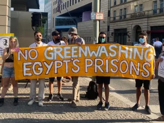
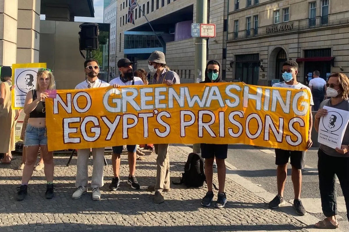
The global climate meeting called COP27 (the 27th Conference of Parties) will be held November 6-18 in the remote Egyptian desert resort of Sharm el Sheikh. Given the repressive nature of the Egyptian government, this gathering will likely be different from others, where there have been large, raucous protests led by civil society groups.
So, as tens of thousands of delegates—from world leaders to climate activists and journalists—descend on Sharm el Sheikh from all over the world, U.S.-based activist Medea Benjamin asked Egyptian journalist Sharif Abdel Kouddous to give his thoughts about the state of Egypt today, including the situation of political prisoners, and how he expects the Egyptian government will act with the eyes of the world upon it.
For those who don’t know or have forgotten, can you give us a quick overview of the nature of the present government in Egypt today?
The 2011 revolution against Hosni Mubarak, an uprising that was part of what has been called the Arab Spring, was very inspiring and had reverberations around the world, from the Occupy Movement in the United States to the Indignados in Spain. But that revolution was crushed in a very brutal way in 2013 by the military, led by General Abdel Fattah al Sisi–who later became president.
Right now, Egypt is ruled by a very tight and closed clique of military and intelligence officers, a circle that is completely opaque. Its decision-making process does not allow for any political participation and it does not brook any kind of dissent or opposition. It seems that the government’s answer to any problems with its citizens is to put them in prison.
There are literally tens of thousands of political prisoners in Egypt right now. We don’t know the exact number because there are no official statistics and this forces lawyers and the very harassed human rights groups to try to painstakingly tabulate the thousands of people who are trapped behind bars.
Over the past few years, we’ve seen Egypt build several new prisons. Just last year Sisi oversaw the opening of the Wadi al-Natrun prison complex. It’s not called a prison complex, it’s called a “rehabilitation center.” This is one of seven or eight new prisons that Sisi himself has dubbed “American-style prisons.”
These prison complexes include within them the courts and judicial buildings, so it makes a conveyor belt from the courthouse to the prison more efficient.
What is the status of this massive group of political prisoners?
The majority of political prisoners in Egypt are held in what is called “pre-trial detention.” Under Egypt’s penal code, you can be held in prison for two years without ever being convicted of a crime. Nearly everyone held in pre-trial detention faces two identical charges: one is spreading false information and the other is belonging to a terrorist organization or an outlawed organization.
The prison conditions are very dire. If you get sick, you are in big trouble. There have been a lot of deaths from medical negligence, with prisoners dying in custody. Torture and other forms of abuse by security forces is widespread.
We’ve also seen the number of death sentences and executions skyrocket. Under the former President Mubarak, in his final decade in office, there was a de facto moratorium on executions. There were death sentences handed down but people were not being put to death. Now Egypt ranks third in the world in the number of executions.
What about other freedoms, such as freedom of assembly and freedom of the press?
Basically, the regime sees its citizens as a nuisance or a threat. All forms of protest or public assembly are banned.
Alleged violations carry very stiff prison sentences. We’ve seen mass arrests sweeps happen whenever there’s any kind of public demonstration and we’ve also seen an unprecedented crackdown on civil society, with human rights organizations and economic justice organizations being forced to scale back their operations or basically operate underground.The people who work for them are subject to intimidation and harassment and travel bans and arrests.
We’ve also seen a massive crackdown on press freedom, a nearly complete takeover of the media landscape. Under Mubarak’s government, there was at least some opposition press, including some opposition newspapers and TV stations. But now the government very tightly controls the press through censorship and also through acquisition. The General Intelligence Services, which is the intelligence apparatus of the military, has become the largest media owner of the country. They own newspapers and TV channels. Independent media, such as the one I work for called Mada Masr, operate on the margins in a very, very hostile environment.
Egypt is the third largest jailer of journalists in the world and imprisons more journalists on charges of spreading false news than any other country in the world.
Can you talk about the case of Alaa Abd El-Fattah, who is probably Egypt’s most famous political prisoner?
Alaa has been behind bars for much of the last decade. He is in prison ostensibly for the crime of “spreading false news,” but he is really in prison for these ideas, for being an icon and a symbol of the 2011 revolution. For the regime, imprisoning him was a way to set an example for everyone else. That’s why there has been so much campaigning to get him out.
He has been in prison under very, very difficult conditions. For two years he wasn’t allowed out of his cell and didn’t even have a mattress to sleep on. He was completely deprived of everything, including books or reading materials of any kind. For the first time, he started expressing suicidal thoughts.
But on April 2 he decided to go on a hunger strike as an act of resistance against his imprisonment. He has been on a hunger strike for seven months now. He started with just water and salt, which is a kind of hunger strike that Egyptians learned from Palestinians. Then in May, he decided to go on a Gandhi-style strike and ingest 100 calories a day–which is a spoonful of honey in some tea. An average adult needs 2,000 calories a day, so it’s very meager.
But he just sent a letter to his family saying that he was going back to a full hunger strike and on November 6, on the eve of the COP meeting, he’s going to stop drinking water. This is extremely serious because the body cannot last without water for more than a few days.
So he is calling on all of us on the outside to organize, because either he will die in prison or he will be released. What he is doing is incredibly brave. He is using his body, the only thing he has agency over, to organize and to push us on the outside to do more.
How do these repressed civil society leaders view the fact that Egypt is playing host to COP27?
It was very disheartening for a lot of people in Egypt who work for human rights and justice and democracy when Egypt was granted the right to host the conference. But Egyptian civil society has not called on the international community to boycott the COP meeting; they have called for the plight of political prisoners and the lack of human rights to be linked to the climate discussions and not ignored.
They want a spotlight to be placed on the thousands of political prisoners like Alaa, like Abdel Moneim Aboul Foitouh, a former presidential candidate, like Mohamed Oxygen, a blogger, like Marwa Arafa, who is an activist from Alexandria.
Unfortunately, hosting this meeting has given the government a great opportunity to remake its image. It has allowed the government to try to position itself as the voice for the Global South and the negotiator trying to unlock billions of dollars a year in climate financing from the Global North.
Of course the issue of climate reparations to the Global South is very important. It needs to be discussed and taken seriously. But how can you give climate reparations to a country like Egypt when you know the money will mostly be spent on bolstering this repressive, polluting state? As Naomi Klein said in her great article Greenwashing a Police State, the summit is going beyond greenwashing a polluting state to greenwashing a police state.
So what do you think we can expect to see in Sharm el Sheikh? Will the usual protests that happen at every COP, both inside and outside the official halls, be allowed?
I think what we are going to see in Sharm el Sheikh is a carefully managed theater. We all know the problems with the UN Climate Summits. There are a lot of negotiations and climate diplomacy, but rarely do they amount to anything concrete and binding. But they do serve as an important place for networking and convergence for different groups in the climate justice movement, an opportunity for them to come together to organize. It has also been a time for these groups to show their opposition to the inaction by those in power, with creative, vigorous protests both inside and outside the conference.
This will not be the case this year. Sharm el Sheikh is a resort in Sinai that literally has a wall around it. It can and will be very tightly controlled. From what we understand, there is a special space that has been designated for protests that has been built out near a highway, far away from the conference center and any signs of life. So how effective will it be to hold protests there?
This is why people like Greta Thunberg are not going. Many activists have problems with the structure of the COP itself but it is even worse in Egypt where the ability to use it as a convergence space for dissent will be effectively shut down.
But more importantly, the members of Egyptian civil society, including the allies and environmental groups that are critical of the government, will not be allowed to attend. In a departure from UN rules, those groups that manage to participate will have been vetted and approved by the government and will have to be very careful about how they operate. Other Egyptians who should be there are unfortunately in prison or are subject to various forms of repression and harassment.
Should foreigners also worry about the Egyptian government surveilling them?
The entire conference will be very highly surveilled. The government created this app that you can download to use as a guide for the conference. But to do that, you have to put in your full name, phone number, email address, passport number and nationality, and you have to enable location tracking. Amnesty International technology specialists have reviewed the app and flagged all these concerns about surveillance and how the app can use the camera and microphone and location data and bluetooth.
What environmental issues related to Egypt will the government allow to be discussed, and what will be off limits?
Environmental issues that will be allowed are issues such as trash collection, recycling, renewable energy and climate finance, which is a big issue for Egypt and for the Global South.
Environmental issues that implicate the government and military will not be tolerated. Take the issue of coal–something the environmental community is very critical of. That will be off limits because coal imports, much of it coming from the United States, have risen over the past several years, driven by the strong demand from the cement sector. Egypt’s largest importer of coal is also the largest cement producer, and that’s the El-Arish Cement Company that was built in 2016 by none other than the Egyptian military.
We’ve seen massive amounts of cement poured into Egypt’s natural environment over the past several years. The government has built nearly 1,000 bridges and tunnels, destroying acres and acres of green space and cutting down thousands of trees. They have gone on a crazy construction spree, building a slew of new neighborhoods and cities, including a new administrative capital in the desert just outside of Cairo. But no criticism of these projects has been or will be tolerated.
Then there is dirty energy production. Egypt, Africa’s second largest gas producer, is scaling up its oil and gas production and exports, which will mean further profits for the military and intelligence sectors involved in this. These projects that are harmful to the environment but profitable for the military will be off the agenda.
The Egyptian military is entrenched in every part of the Egyptian state. Military owned enterprises produce everything from fertilizers to baby food to cement. They operate hotels; they are the largest owner of land in Egypt. So any kind of industrial pollution or environmental harm from areas such as construction, tourism, development and agribusiness will not be tolerated at COP.
We have heard that the crackdown on Egyptians in anticipation of this global gathering has already begun. Is that true?
Yes, we’ve already seen an intensified crackdown and a massive arrest sweep in the run-up to the climate summit. There are arbitrary stop and searches, and random security checkpoints. They open your Facebook and WhatsApp, and they look through it. If they find content that they find problematic, they arrest you.
Hundreds of people have been arrested, by some counts 500 to 600. They have been arrested from their homes, off the streets, from their workplaces.
And these searches and arrests are not restricted just to Egyptians. The other day there was an Indian climate activist, Ajit Rajagopal, was arrested shortly after setting off on an eight-day walk from Cairo to Sharm el Sheikh as part of a global campaign to raise awareness about the climate crisis.
He was detained in Cairo, questioned for hours and held overnight. He called an Egyptian lawyer friend, who came to the police station to help him. They detained the lawyer as well, and held him overnight.
There have been calls for protests on November 11, or 11/11. Do you think people in Egypt will come out on the streets?
It is unclear where these protest calls started but I think it was started by people outside Egypt. I would be surprised if people come out on the streets given the level of repression we’ve been seeing these days but you never know.
The security apparatus was very surprised in September 2019 when a former military contractor turned whistleblower exposed videos showing army corruption. These videos went viral. The whistleblower called for protests but he was outside Egypt in self-imposed exile in Spain.
There were some protests, not very big but significant. And what was the government response? Massive arrests, the most massive sweep since Sisi came to power with over 4,000 people detained. They arrested all kinds of people–everyone who had been arrested before and a lot of other people. With that kind of repression, it’s hard to say if mobilizing people to go to the streets is the right thing to do.
The government is also particularly paranoid because the economic situation is so bad. The Egyptian currency has lost 30 percent of its value since the beginning of the year, precipitated by a variety of factors, including the war in Ukraine, since Egypt was getting so much of its wheat from Ukraine. Inflation is out of control. People are getting poorer and poorer. So that, combined with these calls for protests, have prompted the preemptive crackdown.
So I don’t know if people will defy the government and go out into the streets. But I gave up trying to predict anything in Egypt a long time ago. You just never know what is going to happen.
Medea Benjamin is the cofounder of CODEPINK for Peace, and the author of several books, including Inside Iran: The Real History and Politics of the Islamic Republic of Iran.
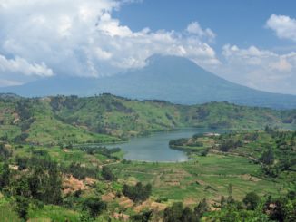
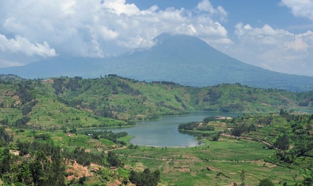
Rwanda is one of the world’s fastest growing economies and is ranked second in Africa as the easiest place to do business. In addition, this landlocked country boasts the world’s record for female representation in parliament. And it’s the only African country that manufactures “Made in Africa” smartphones.
These milestones make for impressive reading in the Western world, so accustomed to morbid news from the most corrupt region of the world.
This has also led major global brands including the world’s biggest car manufacturer, the world’s biggest nuclear company by foreign orders, a major U.S. multinational telecommunications company plus a retinue of other global corporations to set up shop in a country the size of the U.S. state of Maryland.
In the paternalistic eyes and hearts of foreign development partners in Africa, Rwanda is obsequiously referred to as the “Singapore of Africa,” a moniker that gives the impression that all is hunky-dory in this “land of a thousand hills.”
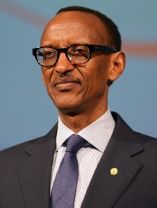
Rwanda’s economic and social accomplishments—while impressive—mask the underbelly of one of the world’s cruelest states, led by Paul Kagame.
Here, freedom of expression is muzzled. Extrajudicial killings are institutionalized. Show trials are routinely encouraged. Forced disappearances are embraced, while private businesses are forcibly seized by a regime that operates like the Nazi Gestapo.
Despite evidence of Kagame ordering his political opponents to be murdered, arrested, jailed, kidnapped, assassinated and tortured, the international community has continued to turn the other way. Why is that the case in Rwanda, but not in countries like Ethiopia, where U.S. Secretary of State Antony Blinken has called for a ceasefire to allow for humanitarian aid to flow into the Tigray region?
The President and the ruling Rwanda Patriotic Front (RPF) have built and fine-tuned over the decades a totalitarian police state in which criticism of the government, or any semblance of dissent, is criminalized and often results in death for those who dare to speak out, said Jeffrey Smith, founding director of Vanguard Africa. He told TF in an email exchange, “There is no independent media, nor independent human rights groups or a political opposition that are allowed the minimum space to operate. The ruling RPF, in essence, has been wholly conflated with the state,” says Smith.
The 1994 genocide killed about 800,000 people drawn mainly from the minority Tutsi community, including moderate Hutus, while the rest of the world silently looked on. But Rwanda has since experienced an economic recovery that has been inextricably linked to Kagame, who officially took power in 2000.
In a controversial 2015 constitutional referendum, Rwandans voted overwhelmingly to allow Kagame, 63, to stand again for office beyond the end of his second term, which ended in 2017. He won elections held the same year with nearly 99 percent of the vote. In theory, he could run twice again, keeping him in power until 2034. His current term ends in 2024.
So why does the Western world play blind and deaf to the excess exhibited by Kagame? In other words, why the complicity in crimes and misdeeds in Rwanda ever since the end of the genocide?
“Rwanda has performed exceedingly well on the economic front. It’s seen as a success story in a continent that is dotted with malfunctioning states,” Lewis Mudge, the Central Africa Director at Human Rights Watch (HRW) told TF in a telephone interview. “The international donor community loves a good story and Rwanda serves as an example.”
Mudge added Western collective guilt after the 1994 genocide also weighed in.
The United States and the United Kingdom, like other Western governments, did not intervene in the 1994 Rwandan genocide. Nonetheless, both U.S. President Bill Clinton and U.K. Prime Minister Tony Blair later emerged as moralists and humanitarian interventionists, claiming human rights as one of the guiding principles for U.S. and British leadership in the world. This argument has since been used to bomb Yugoslavia, and invade Afghanistan, Iraq, Libya and Syria.
However, a U.S. diplomat quoted in the New York Times in an article aptly titled, “The Global Elite’s Favorite Strongman,” explained the reason the West disregarded the atrocities happening in Rwanda. “You put your money in, and you get results out. We needed a success story, and he was it.”
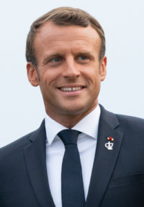
In late May, French President Emmanuel Macron travelled to Rwanda, formerly a French colony, in a gesture largely aimed at fixing a glacial relationship that had broken down as a result of the latter having backed the former extremist government in Rwanda, including supporting and training its military, which committed genocide.
In addition, France is determined to win back its influence in former French colonies in Africa, including in Rwanda. Some have begun cooperating with other powers, among them China and Turkey, said Arrey E. Ntui, a researcher with the International Crises Group (ICG).
“The French Government is currently not that popular in Africa as a result of its past exploitative history with African states,” said Ntui. “The current leadership in Africa is assertive and takes no prisoners. This calls for France to tread carefully because there are emerging nations that are willing to partner with Africa without a condescending attitude. So it would have been foolhardy, for example, for Macron to censure his Rwandan counterpart on account of real or imagined human rights abuses happening in Rwanda.”
Since his inauguration in May 2017, Macron has visited 18 African countries out of 62 states he has so far visited, a sign that he is determined to claw back the influence France once had when it counted 20 countries as its colonies within the African continent.
But should the world expect an insurgency anytime soon in Rwanda?
Victoire Ingabire Umuhoza, a former presidential contestant who has been jailed for 15 years for daring to challenge Kagame told TF the Kagame government took power after a war and genocide.
“I would say that all these crimes committed in our country have traumatized Rwandans,” Umuhoza said. “Moreover, there is no room for dissenting voices in Rwanda. If one criticizes the government they are immediately labeled as the enemy of the state. Under such circumstances, people live in constant fear of expressing themselves. But this silence worries me a lot because it can lead to implosion in Rwanda one day.”
U.S. National Intelligence Council’s Global Trends Report published every five years says the world is “at a critical juncture in human history” and warns that a number of countries are at high risk of becoming failed states by 2030—Rwanda being one of them.
Charles Wachira is a foreign correspondent based in Nairobi, Kenya, and is formerly an East Africa correspondent with Bloomberg. He covers issues including human rights, business, politics and international relations.
Copyright Toward Freedom 2019